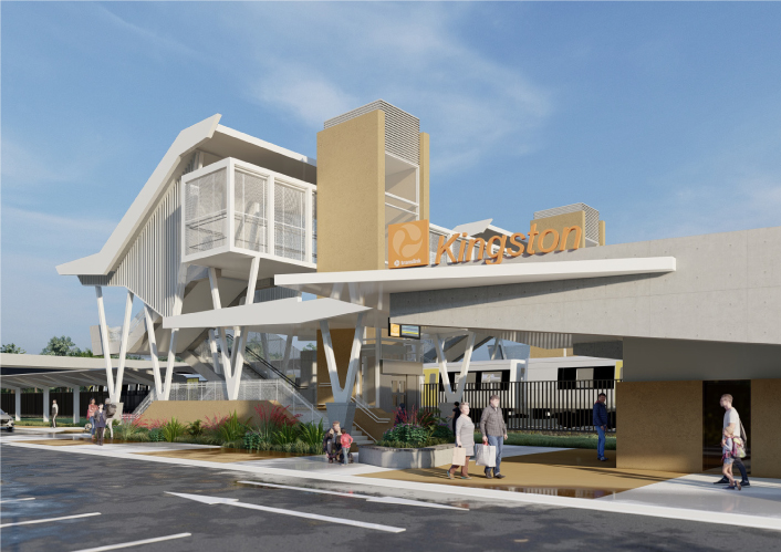
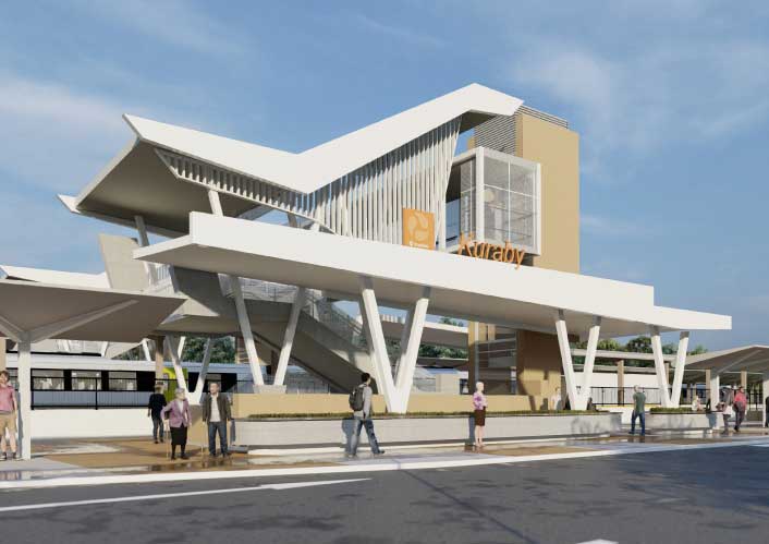
Beenleigh train station upgrade
Beenleigh train station is a key transfer location between all-stops and express services on the Beenleigh and Gold Coast train lines.
In 2021, we received community feedback that highlighted strong support for integrating the station with the Town Square, nearby shops, local facilities, and essential services to create community focused spaces and precincts.
Based on this feedback and the need for track straightening to improve station accessibility, we are relocating Beenleigh train station approximately 650m north of its current location to James and Victoria Streets, near the Town Square and Magistrates Court. This is a change from the original proposed location which was 200m south of the existing station.
The new location will allow the existing train station to remain open during construction, reducing disruptions to the rail and local road networks, commuters, and the Beenleigh community.
As part of the Logan and Gold Coast Faster Rail project, the level crossings at Holmview Road and Spanns Road in Beenleigh will also be closed.
Benefits
- Improves safety
- Accessibility
- Increases capacity
- Improves network efficiency
- Reduces peak hour congestion
- Reduces travel time
- Contributes to economy
- Better active transport
- Better road access
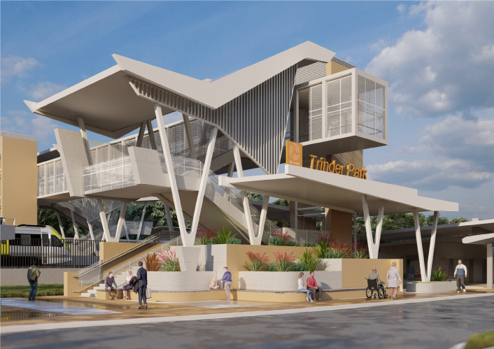
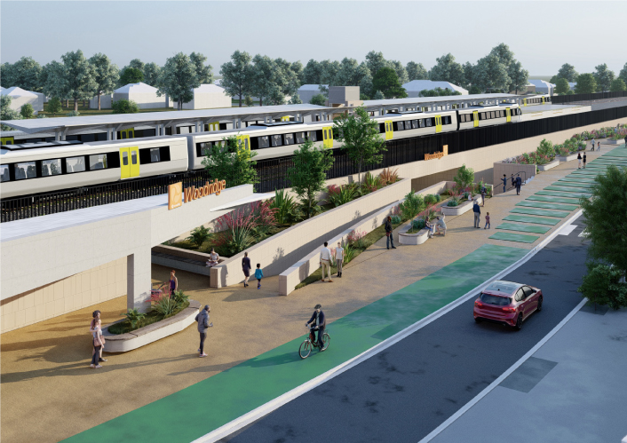
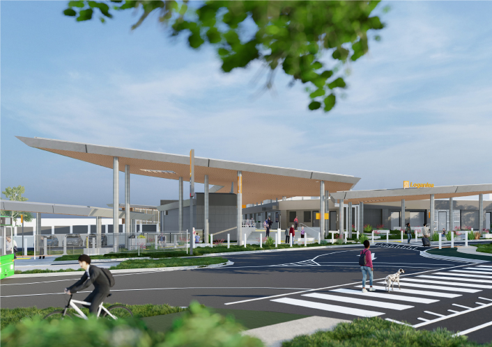
Key features
As part of the Logan and Gold Coast Faster Rail project, the Beenleigh train station upgrade will provide:
- better integration with the local precinct and facilities, with improved connectivity and walk-up catchment
- improved station accessibility with new lifts, straightened and raised platforms, hearing loops, accessible car parks and flush kerbing
- improved safety and customer experience with lighting and CCTV throughout the station and car park and increased platform coverage
- a pedestrian overpass connecting both sides of the rail line
- improved park ‘n’ ride and kiss ‘n’ ride facilities to make accessing the station easier
- better active transport connections and a secure bicycle enclosure.
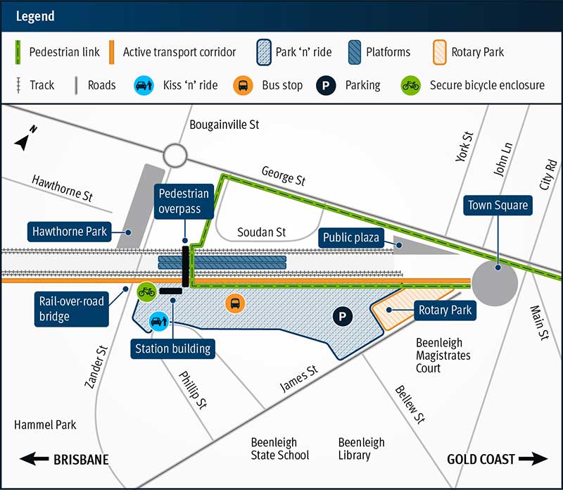
Beenleigh train station proposed layout
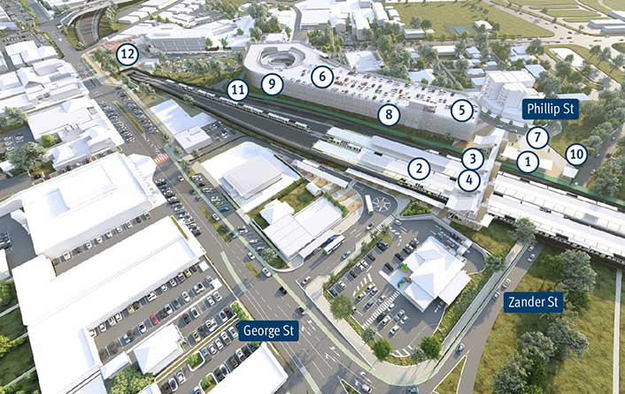
Legend
- Station building and ticketing
- Covered platforms
- Lift and stairs to platforms
- Pedestrian overpass
- Improved safety with lighting and CCTV throughout station and car park
- Park 'n' ride
- Kiss 'n' ride
- Accessible parking spaces
- Bus station
- Secure bicycle enclosure
- Connection to active transport
- Beenleigh Town Square
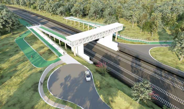
Level crossing closures
We are making changes to the level crossings at Holmview Road and Spanns Road in Beenleigh.
Holmview Road level crossing
We will be closing the level crossing at Holmview Road, Beenleigh.
The closure is the result of a range of factors including safety concerns and current and projected traffic counts in the area. A new road will be constructed, connecting Holmview Road to Chapman Drive to maintain access for the community. As a part of this closure, a new pedestrian connection will be provided over the rail corridor at Holmview Road.
Flood resilience was considered as part of the design for this new road.
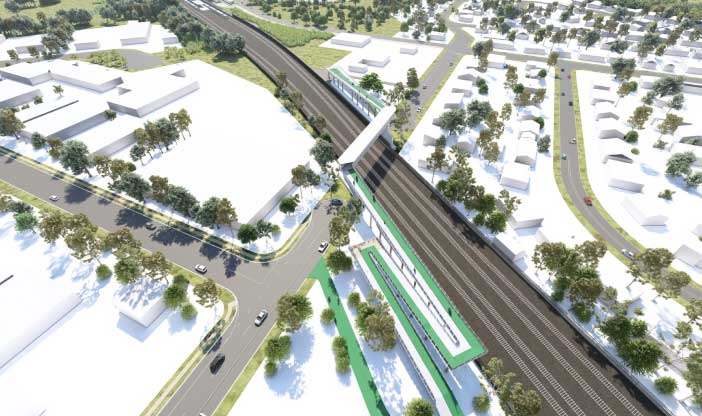
Spanns Road level crossing
We will be closing the Spanns Road level crossing after our investigations and further assessments of traffic counts and flood modelling.
The closure of the level crossing will include:
- both sides of Spanns Road to be turned into cul-de-sacs
- improvements to local roads and alternative access routes
- upgrade to the intersections at Chapman Drive and Boundary Street, and Boundary and Kokoda streets.
Flood resilience upgrades will also be delivered along Kokoda Street and new pedestrian connections will be provided over the rail corridor at Spanns Road.
Current status
We are currently reviewing your feedback from the community engagement we held between November and December 2023 with findings to be released in early 2024.
The procurement process started in late 2023 and we expect to appoint contractors by late 2024, subject to government approvals.
Construction timeframes will be confirmed once contractors have been appointed.
Beenleigh train station project concept map—subject to change