
Brisbane Road service road design change
Go back to Sunshine Motorway, Mooloolah River Interchange Upgrade (Stage 1) project page >>
The Department of Transport and Main Roads is providing an update about the Sunshine Motorway, Mooloolah River Interchange (MRI) Upgrade.
Community feedback about the project’s planning layout is being considered as design work progresses. We thank the community and key stakeholders for feedback and helping shape this significant infrastructure upgrade.
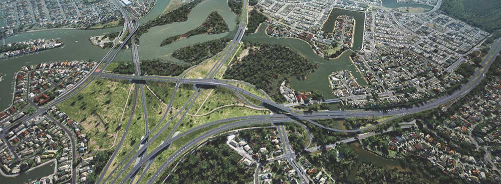
The MRI project will deliver a safe, efficient, and effective transport network to meet the current and future needs of the Sunshine Coast. It will also improve access and active transport connectivity for local communities in the Birtinya, Mountain Creek and Mooloolaba areas.
Service road design change
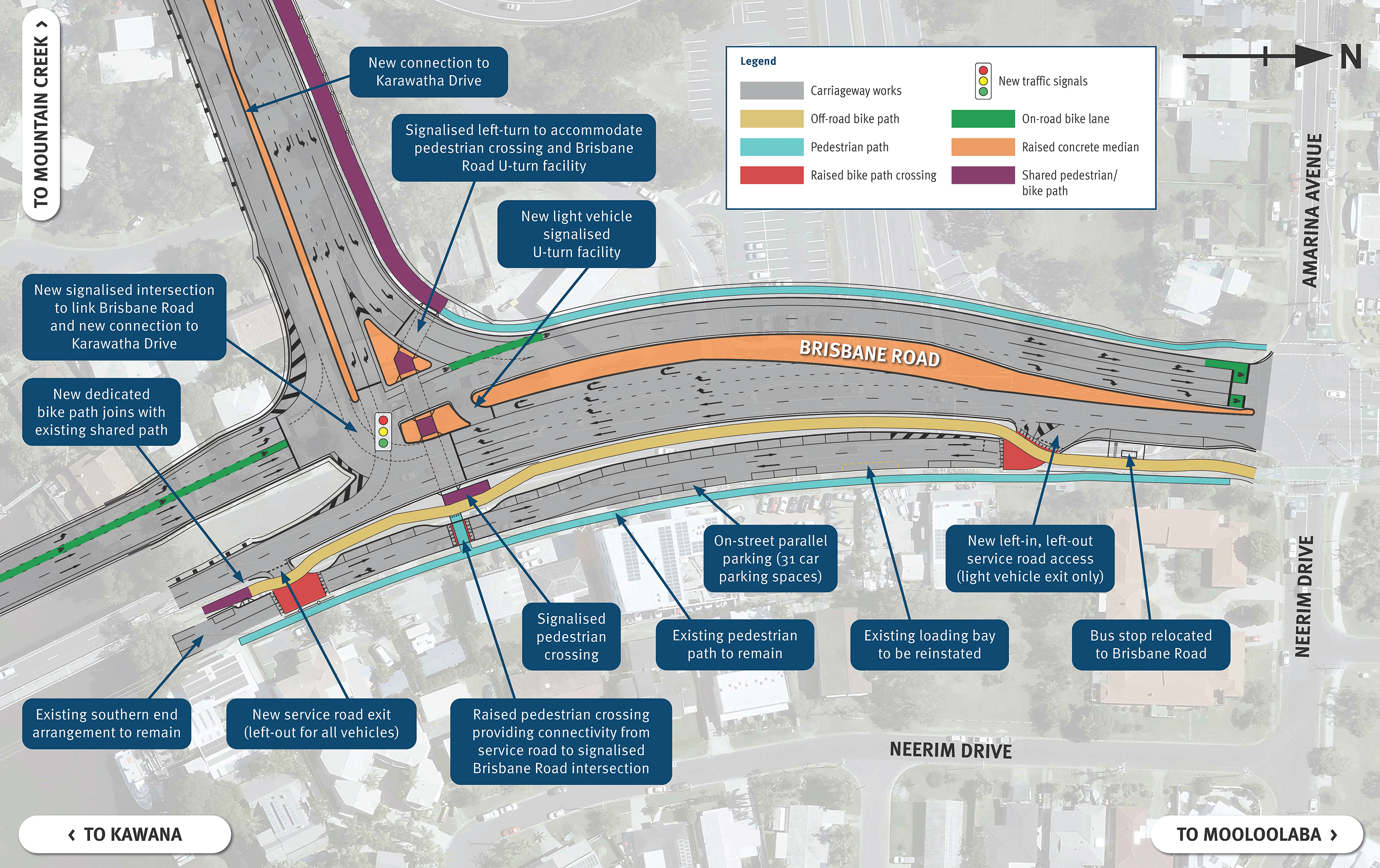
A key component of Stage 1 of the MRI project is a new road connecting Brisbane Road to Karawatha Drive. This creates a new intersection on Brisbane Road and will require changes to the existing service road.
The planning layout released in July 2021 included a proposed access change to the Brisbane Road service road through Neerim Drive and Neerim Park. Concerns raised by the community about this proposed change included:
- impacts to Neerim Park and the loss of public green space
- no direct access to the service road from Brisbane Road
- potential impacts to Neerim Drive traffic volumes.
Following community feedback, TMR investigated alternative access options and refined the design to benefit surrounding residents, businesses and road users. Importantly, the design change means there will be no impact to Neerim Park and this public green space will be preserved for the community to enjoy.
Key features
Key features of the refined design include:
- access through Neerim Park being removed to preserve public green space
- a two-way service road with direct Brisbane Road access at the northern end
- an additional service road exit to Brisbane Road at the southern end (left-turn only)
- a new signalised U-turn facility on Brisbane Road to enable motorists exiting the service road to travel northbound to Mooloolaba
- on-street parallel parking on the service road (includes 31 car parking spaces)
- a dedicated off-road bike path on Brisbane Road providing connectivity to the Mooloolaba to Minyama Separated Bikeway
- raised bike path crossings at service road entry and exits to improve visibility and safety
- a raised pedestrian crossing providing connectivity from the service road to the signalised intersection on Brisbane Road
- the existing bus stop on the service road relocated to Brisbane Road for easier access and improved safety.
Project map
Project stages
Due to the complexity of the MRI Upgrade project, it will be delivered in stages to keep traffic flowing and minimise inconvenience to road users and the community.
The Australian Government and Queensland Government have jointly committed $320 million on a 50:50 (federal:state) basis to deliver Stage 1 of the project. This will include:
- a new road overpass to provide a more direct and efficient connection from Nicklin Way to Brisbane Road at Mooloolaba
- a new local road connection between Karawatha Drive at Mountain Creek and Brisbane Road at Mooloolaba.
Future stages will deliver:
- a new crossing over the Mooloolah River, connecting the Sunshine Motorway to Kawana Way
- the MRI, with connections to the Sunshine Motorway to the west and north, Nicklin Way to the south-east, and Kawana Way to the south
- an upgrade of the Sunshine Motorway from two to four lanes between the existing Kawana Way interchange and the MRI
- a direct, safe and efficient connection for the Sunshine Motorway, north to west
- an additional northbound lane on the Sunshine Motorway from the MRI to the Buderim-Mooloolaba interchange.
Funding is required to progress future stages to construction.
Project status
We undertook community consultation on the project’s planning layout in July and August 2021. A copy of this layout can be viewed by visiting the project web page.
Further public feedback was welcomed via an online interactive map in March and April 2022. We are considering community feedback as design work progresses.
On-site field investigation activities have also been undertaken since March 2022 to help inform the design and will continue until mid 2023, weather and site conditions permitting. Investigations are being undertaken on land and in neighbouring river locations, with most activities carried out on Queensland Government land.
A design layout for the entire MRI Upgrade project will be released to the community in the coming months. Construction timeframes will be determined as part of the design phase.
Early works
It is anticipated that early works for Stage 1 of the project will start by mid-2023. These will make the site construction ready and involve:
- property demolitions
- land preparation works
- service relocations for electricity, water and telecommunications
- settlement of soft soils.
We will continue to update the community and stakeholders as the project progresses.